
Increasing the Accuracy of a Waypoint
Location
You can refine a waypoint location for more accuracy. When
averaging, the device takes several readings at the same
location and uses the average value to provide more accuracy.
1
Select Waypoint Manager.
2
Select a waypoint.
3
Select > Average Location.
4
Move to the waypoint location.
5
Select Start.
6
Follow the on-screen instructions.
7
When the confidence status bar reaches 100%, select Save.
For best results, collect 4 to 8 samples for the waypoint, waiting
at least 90 minutes between samples.
Projecting a Waypoint
You can create a new location by projecting the distance and
bearing from a marked location to a new location.
1
Select Waypoint Manager.
2
Select a waypoint.
3
Select > Project Waypoint.
4
Enter the bearing, and select .
5
Select a unit of measure.
6
Enter the distance, and select .
7
Select Save.
Routes
A route is a sequence of waypoints or locations that leads you to
your final destination.
Creating a Route
1
Select Route Planner > Create Route > Select First Point.
2
Select a category.
3
Select the first point in the route.
4
Select Use > Select Next Point.
5
Repeat steps 2–4 to add all the points in the route.
6
Select to save the route.
Editing the Name of a Route
1
Select Route Planner.
2
Select a route.
3
Select Change Name.
4
Enter the new name.
Editing a Route
1
Select Route Planner.
2
Select a route.
3
Select Edit Route.
4
Select a point.
5
Select an option:
• To view the point on the map, select Review.
• To change the order of the points on the route, select
Move Up or Move Down.
• To insert an additional point on the route, select Insert.
The additional point is inserted before the point you are
editing.
• To remove the point from the route, select Remove.
6
Select to save the route.
Viewing a Route on the Map
1
Select Route Planner.
2
Select a route.
3
Select View Map.
Deleting a Route
1
Select Route Planner.
2
Select a route.
3
Select Delete Route.
Viewing the Active Route
1
While navigating a route, select Active Route.
2
Select a point in the route to view additional details.
Reversing a Route
1
Select Route Planner.
2
Select a route.
3
Select Reverse Route.
Garmin
®
Adventures
You can create adventures to share your journeys with family,
friends, and the Garmin community. You can group related
items together as an adventure. For example, you can create an
adventure for your latest hiking trip. The adventure could contain
the track log of the trip, photos of the trip, and geocaches you
hunted. You can use BaseCamp
™
to create and manage your
adventures. For more information, go to adventures.garmin.com.
NOTE: BaseCamp is not available for all device models.
Sending Files to BaseCamp
1
Open BaseCamp.
2
Connect the device to your computer.
On Windows
®
computers, the device appears as a removable
drive or a portable device, and the memory card may appear
as a second removable drive. On Mac
®
computers, the device
and memory card appear as mounted volumes.
NOTE: Some computers with multiple network drives may not
display device drives properly. See your operating system
documentation to learn how to map the drive.
3
Open the Garmin or memory card drive or volume.
4
Select an option:
• Select an item from a connected device and drag it to My
Collection or to a list.
• From BaseCamp, select Device > Receive from Device,
and select the device.
Creating an Adventure
Before you can create an adventure and send it to your device,
you must download BaseCamp to your computer and transfer a
track from your device to your computer (Sending Files to
BaseCamp, page 3).
1
Open BaseCamp.
2
Select File > New > Garmin Adventure.
3
Select a track, and select Next.
4
If necessary, add items from BaseCamp.
5
Complete the required fields to name and describe the
adventure.
6
If you want to change the cover photo for the adventure,
select Change, and select a different photo.
Routes 3



Join the conversation about this product
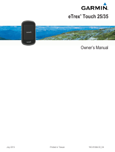
Here you can share what you think about the Garmin eTrex Touch 35 Handheld Navigation. If you have a question, first carefully read the manual. Requesting a manual can be done by using our contact form.
reply | This was helpful (0) (Translated by Google)